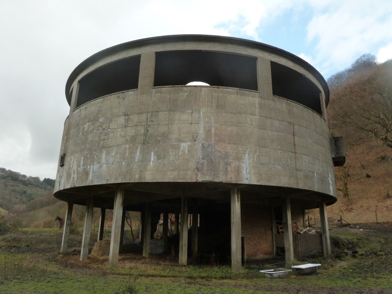
The site was cleared in 1985 only leaving the distinctive round building which was part of the washery. The area has been extensively landscaped.
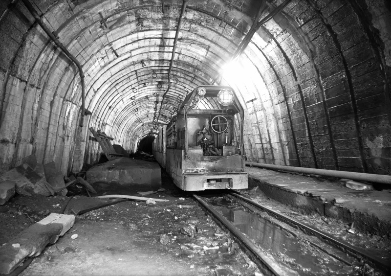
The mine was driven in 1955 by the National Coal Board to connect existing collieries together in a ‘super pit.’ The mine connected together the original Hafodyrynys colliery, Tirpentwys Colliery, Glyntillery and later Blaenserchan Colliery.
New drifts were sunk including:
- No1 - depth of 232 metres at 1 in 150 - Main drift and manriding road.
- No2 - depth of 247 metres at 1 in 8 - Tillery trunk and intake.
- No3 - at 1 in 20 - Return air road from the Glyntillery side of the mine.
- No4 - depth of 418 metres at 1 in 4 - This was the main roadway to Tirpentwys.
A detailed plan of main drifts and roadways can be seen at the NMRS link below.
The mine worked the following seams:
- Tillery,
- Elled,
- Old,
- Big,
- Meadow,
- Lower Three Quarters.
Output was around 490,000 tons per year.
Hafodyrynys closed in 1969 and Glyntillery closed in 1975 marking the end of the Hafodyrynys new mine.
Washery is next to a large parking area.
External Links
- https://coflein.gov.uk/en/site/91476/
- https://museum.wales/collections/online/?field0=with_images&value0=1&field1=string&value1=%20Hafodyrynys%20new%20drift%20mine%2C%20photograph&page=1
- https://www.nmrs.org.uk/mines-map/coal-mining-in-the-british-isles/swales/abercarn/hafodyrynys-colliery/
- https://www.welshcoalmines.co.uk/Gwent/Hafodyrynys.htm
Publications (1)
- Cooke, R.A.; Lightmoor Press (2018); Gazeteer of Coal mines in South Wales and Monmouthshire


