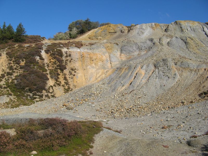
Ancient mine, as evidenced by a map dating back to around 1810, which depicts a series of costeen pits aligned east-west along an old tin lode. Several shafts are marked on the map, including Bread and Cheese Engine Shaft, Nangiles Engine Shaft, Phillips Shaft, and Tregonings Shaft, with Little Bread and Cheese Engine Shaft located to the south. In 1808, it was known as Nangiles and Bread and Cheese Mine, equipped with a steam engine, and was actively mining copper, zinc, and tin.
The mine continued operations intermittently, with records showing activity in 1845 before closing in 1848 alongside Wheal Andrew, located on the opposite side of the river. Despite selling blende in 1856, work ceased shortly thereafter. Nangiles was reopened in 1862, and by 1864, it had reached a depth of 117 fathoms below adit, equipped with an 80-inch pumping engine, 30-inch stamps, and a winding engine. By 1870, it had expanded to a depth of 160 fathoms and employed around 90 workers, primarily focused on extracting pyrite.
Jenkin notes the corrosive nature of the water, necessitating the lining of pumps with brass, which proved financially detrimental to the company. Presently, the mine is characterized by a striking, colorful spoil heap topped by the truncated remnants of the pumping engine house on Engine Shaft.
18th C. -1856 1862-
Whilst on CRoW land, the mine is owned by the Tregothnan Estate who request that people stay well away from all mine workings, which are well signed and generally fenced.
External Links
Publications (6)
- (1920); BGS - Mineral Resources of GB (c1920s) Vols XIV, XV, XVI, XVII, XVIII - Fireclay; Arsenic & Antimony Ores; Refactory Materials, Lead & Zinc of Scotland, Rock-Salt and Brine (5 books); 777 pages
- Anon; Nangiles; 1 pages
- Anon; Nangiles; 1 pages
- Dines, Henry George (1956); BGS - Regional Memoirs - Metalliferous Mining Region of South West England Vol1, The; 567 pages
- Nangiles Section; 1 pages
- NMRS (1973); Memoirs Vol2, No.3; pp.161.


