Including Sparnon after 1864. Long history of operation, dating back to the early 18th century, and continued intermittently until 1891. It exploited several ENE-trending lodes within metamorphosed killas above the west flank of the Carn Marth granite. Situated beneath Redruth town, the mine’s shafts are now covered, and most of the smaller mines within its sett cannot be identified today.
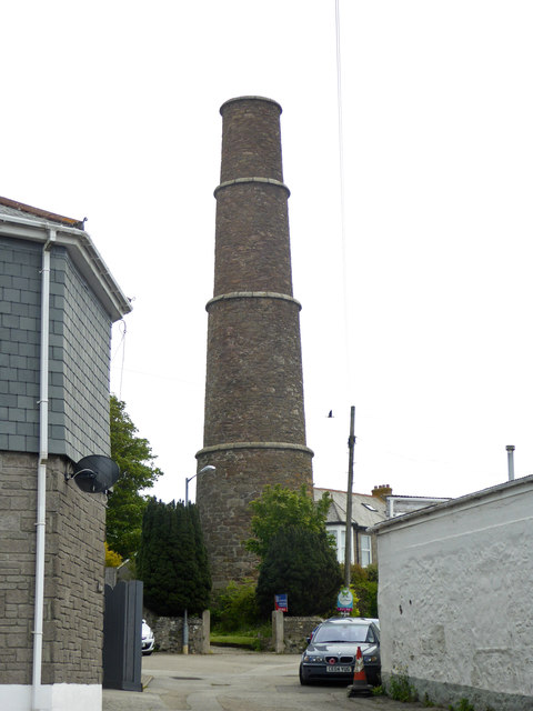
The coordinates provided mark the location of a stepped chimney near Engine and Sump shafts, erected around 1824. The lodes intersect two NW-trending cross-courses, roughly 100 fathoms apart. The western cross-course is reputed to carry cobalt ores and extends southwards to Wheal Sparnon. The eastern cross-course, known as Braggs cross-course, likely contains uranium ores.
During its final working period from 1854 to 1891, the mine was a significant producer, yielding 1,090 tons of copper ore at 5.5% concentration, 7,700 tons of black tin, and, in conjunction with Wheal Sparnon, 974 tons of arsenic. It was the predominant tin producer in the area.
1760s -1806 1824-1834 1854-1891
External Links
Publications (8)
- (1862); Pedn-an-Drea Mine; 9 pages
- (1920); BGS - Mineral Resources of GB (c1920s) Vols XIV, XV, XVI, XVII, XVIII - Fireclay; Arsenic & Antimony Ores; Refactory Materials, Lead & Zinc of Scotland, Rock-Salt and Brine (5 books); 777 pages
- Collins, J.H. (1912); Observations of the West of England Mining Region; 753 pages
- Dines, Henry George (1956); BGS - Regional Memoirs - Metalliferous Mining Region of South West England Vol1, The; 567 pages
- NMRS; British Mining 5 - Memoirs 1977; pp.8-9.
- Palmer, M. & Neaverson, P.; NMRS (1987); British Mining 32 - Basset Mines, The; ISBN 0901450 31 6; pp.65.
- Pedn an Drea Section; 1 pages
- Pedn an Drea Section; 1 pages


